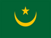
Mauritania
Background:
Independent from France in 1960, Mauritania annexed the southern third of the former Spanish Sahara (now Western Sahara) in 1976, but relinquished it after three years of raids by the Polisario guerrilla front seeking independence for the territory. Opposition parties were legalized and a new constitution approved in 1991.
Two multiparty presidential elections since then were widely seen as being flawed; Mauritania remains, in reality, a one-party state.
The country continues to experience ethnic tensions between its black minority population and the dominant Maur (Arab-Berber) populace. .
(Source: CIA - The World Factbook)
People: Nationality: Mauritanian(s). Population: 2.5 million. Ethnic groups: Arab-Berber (White Moor or Beydane), Arab-Berber-Negroid (Black Moor or Haritine), Haalpulaar, Soninke, Wolof. Religion: Islam. Languages: Arabic (official), French, Pulaar, Wolof, and Soninke. Literacy: 42%. Natural resources: Fish, copper, iron ore, gypsum. Diplomatic Missions Embassy of Mauritania Ottawa, Canada Embassy of Islamic Republic of Mauritania Washington D.C. Agriculture products: Dates, millet, sorghum, rice, corn, cattle, sheep. Industries: Fish processing, mining of iron ore and gypsum. Exports partners: Japan 12.5%, France 12.1%, Spain 11.4%, Italy 10.4%, Belgium 7.8%, Germany 7.4%, Russia 5%, Cote d'Ivoire 4.2%, Netherlands 4% (2003) Imports partners: France 16.8%, Spain 7.7%, China 6.3%, Belgium 5.1%, Germany 4.9%, Japan 4.3%, UK 4.1%, USA 4% (2003) Currency: Ouguiya (MRO) Mauritania is a member state of the League of Arab States border countries: Algeria, Mali, Senegal, Western Sahara related countries: France
Official Name:
Islamic Republic of Mauritania
conventional short form: Mauritania
short form: Muritaniyah
local long form: Al Jumhuriyah al Islamiyah
al Muritaniyah
ISO Country Code: mr
Actual Time: Mon-Oct-25 13:32
Local Time = No UTC no GMT offset
Country Calling Code: +222
Capital City: Nouakchott (pop. 800,000)
Other Cities:
Nouadhibou (113,000), Selibaby (107,000),
Kaedi (91,000), Kiffa (77,000), Rosso (63,000),
Zouerate (36,000).
Government:
Type: Republic.
Independence: November 28, 1960 (from Fance).
Constitution: Approved 1991. Military rule
1978-1992. Original constitution promulgated 1961
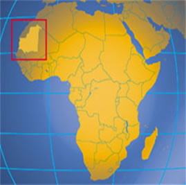
Geography:
Location: Northern Africa, bordering the North
Atlantic Ocean, between Senegal and Western Sahara.
Area: 1,030,070 sq. km. (419,212 sq. mi.)
Terrain: Northern four-fifths barren desert;
southern 20% mainly Sahelian with small scale
irrigated and rainfed agriculture in the Senegal
River basin.
Climate: Predominantly hot and dry.