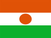
Niger
Background:
Despite the fact that the country has some of the world's largest uranium deposits, Niger is one of the poorest countries in the world, a landlocked Sub-Saharan nation, whose economy centers on subsistence crops and livestock.
Niger suffered austere military rule for much of its post-independence history. Not until 1993, 33 years after independence from France, did Niger hold its first free and open elections. A 1995 peace accord ended a five-year revolt by Tuareg tribes, who accused the government of failing to deliver on promised economic aid. Coups in 1996 and 1999 were followed by the creation of a National Reconciliation Council that effected a transition to civilian rule in December 1999.
People: Nationality: Nigerien(s). Population 11.5 million. Ethnic groups: Hausa 56%, Djerma 22%, Fula 8.5%, Tuareg 8%, Beri Beri (Kanuri) 4.3%; Arab, Toubou, and Gourmantche 1.2%. Religions: Islam (95%); remainder indigenous beliefs and Christian. Languages: French (official), Hausa, Djerma, Fulfulde, Kanuri, Tamachek, Toubou, Gourmantche, Arabic. Literacy: 15-30% Natural resources: Uranium, coal, iron ore, tin, phosphates, gold, petroleum. Diplomatic Missions Mission permanente du Niger auprčs de l'Organisation des Nations Unies Marginal site of the representation of Niger to the UN. The United Nations Development Programme in Niger The information on this UNDP Niger site is not very up-to-date (in French). Agriculture products: Millet, sorghum, rice, corn, fruits, vegetables, cotton, peanuts, cassava, cowpeas. Industries: Uranium mining, cement, brick, textiles, food processing, chemicals . Currency: CFA Franc (XOF) related countries: France border countries: Algeria, Benin, Burkina Faso, Chad, Libya, Mali, Nigeria
Official Name:
Republique du Niger
short form: Niger
int'l long form: Republic of Niger
ISO Country Code: ne
Time:
Local Time = UTC +1h
Actual Time: Mon-Oct-25 14:33
Country Calling Code: +227
Capital City: Niamey (pop. approx. 675 000)
Other Cities: Tahoua, Maradi, Zinder, Diffa,
Dosso, Arlit, and Agadez.
Government:
Type: Republic, multiparty Presidential regime.
Head of State: President Mamadou Tandja
Independence: 3 August 1960 (from France).
Geography:
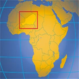
Location: Western Africa, southeast of Algeria.
Area: 1 267 000 sq. km (490 000 sq. mi.).
Terrain: About two-thirds desert and mountains,
one-third savanna.
Climate: Hot, dry, and dusty; tropical in extreme
south. Rainy season June - September.